| |
|
 |
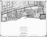
| A Plan of the Ground Alloted by His Excelance Governor Grant for the Troops |
|
| Creator: | |
Anon.
|
| Format: | |
map
|
| Subjects.Display: | |
Plan
|
| Source Institution: | |
University of Florida
|
|
| A Plan of the Ground Alloted by His Excelance Governor Grant for the Troops |
|
 |
| St. Augustine the Capital of East Florida |
|
| Creator: | |
Thomas Jefferys
|
| Format: | |
map
|
| Subjects.Display: | |
Plan
|
| Source Institution: | |
University of Florida
|
|
| St. Augustine the Capital of East Florida |
|
|
 |
| A Plan of St. Aug. |
|
| Creator: | |
Anon.
|
| Format: | |
map
|
| Subjects.Display: | |
Plan
|
| Source Institution: | |
University of Florida
|
|
| A Plan of St. Aug. |
|
 |
| Map of the General Surveys of East Florida |
|
| Creator: | |
Wm. Gerard De Brahm
|
| Format: | |
map
|
| Subjects.Display: | |
Map
|
| Source Institution: | |
University of Florida
|
|
| Map of the General Surveys of East Florida |
|
|
 |
| A Plan of Pensacola and its Environ. |
|
| Creator: | |
Joseph Purcell
|
| Format: | |
map
|
| Subjects.Display: | |
Plan
|
| Source Institution: | |
University of Florida
|
|
| A Plan of Pensacola and its Environ. |
|
 |
| Plan and Sections of the Look-out house at St. Augustine |
|
| Creator: | |
[Copyist] Wm. Brasier ( contributor )
|
| Format: | |
map
|
| Subjects.Display: | |
Plan
|
| Source Institution: | |
University of Florida
|
|
| Plan and Sections of the Look-out house at St. Augustine |
|
|
 |
| The Coast of West Florida and Louisiana |
|
| Creator: | |
Thomas Jefferys
|
| Format: | |
map
|
| Subjects.Display: | |
Map
|
| Source Institution: | |
University of Florida
|
|
| The Coast of West Florida and Louisiana |
|
 |
| The Peninsula and Gulf of Florida, or New Bahama Channel, with the Bahama Islands |
|
| Creator: | |
Thomas Jefferys
|
| Format: | |
map
|
| Subjects.Display: | |
Map
|
| Source Institution: | |
University of Florida
|
|
| The Peninsula and Gulf of Florida, or New Bahama Channel, with the Bahama Islands |
|
|
 |
| Sketch of St. Augustine and its Environs |
|
| Creator: | |
H. Burrard
|
| Format: | |
map
|
| Subjects.Display: | |
Plan
|
| Source Institution: | |
University of Florida
|
|
| Sketch of St. Augustine and its Environs |
|
 |
| Plano de un Fuerte de…Panzacola |
|
| Creator: | |
Phelipe Feringan Cortes
|
| Format: | |
map
|
| Subjects.Display: | |
Plan
|
| Source Institution: | |
University of Florida
|
|
| Plano de un Fuerte de…Panzacola |
|
|
 |
| Plan of Mobile, Surveyed by P. Pitman |
|
| Format: | |
map
|
| Subjects.Display: | |
Plan
|
| Source Institution: | |
University of Florida
|
|
| Plan of Mobile, Surveyed by P. Pitman |
|
 |
| Inset of St. Augustine From: General Map of the Southern British Colonies…East + West Florida |
|
| Format: | |
map
|
| Subjects.Display: | |
Plan
|
| Source Institution: | |
University of Florida
|
|
| Inset of St. Augustine From: General Map of the Southern British Colonies…East + West Florida |
|
|
 |
| A Plan of St. Augustine Town and its Environs in East Florida |
|
| Creator: | |
Joseph Purcell
|
| Format: | |
map
|
| Subjects.Display: | |
Plan
|
| Source Institution: | |
University of Florida
|
|
| A Plan of St. Augustine Town and its Environs in East Florida |
|
 |
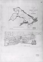
| S. Augustín Capitale de la Floride Orientale; La Baye de Spiritu Santo |
|
| Creator: | |
William Faden
|
| Format: | |
map
|
| Subjects.Display: | |
Map
|
| Source Institution: | |
University of Florida
|
|
| S. Augustín Capitale de la Floride Orientale; La Baye de Spiritu Santo |
|
|
 |
| A Map of the Road from Pensacola in W. Florida to St. Augustine in E. Florida |
|
| Creator: | |
Joseph Purcell
|
| Format: | |
map
|
| Subjects.Display: | |
Map
|
| Source Institution: | |
University of Florida
|
|
| A Map of the Road from Pensacola in W. Florida to St. Augustine in E. Florida |
|
 |
| Plan of the city and fort of San Agustin, its environments and plan of attacks |
|
| Creator: | |
Anon.
|
| Format: | |
map
|
| Subjects.Display: | |
Plan
|
| Source Institution: | |
University of Florida
|
|
| Plan of the city and fort of San Agustin, its environments and plan of attacks |
|
|
 |
| Fort of San Agustin, Florida |
|
| Creator: | |
Anon.
|
| Format: | |
map
|
| Subjects.Display: | |
Plan and Profile
|
| Source Institution: | |
University of Florida
|
|
| Fort of San Agustin, Florida |
|
 |
| Plano del Presidio de San Agustin de la Florida |
|
| Creator: | |
Anon.
|
| Format: | |
map
|
| Subjects.Display: | |
Plan
|
| Source Institution: | |
University of Florida
|
|
| Plano del Presidio de San Agustin de la Florida |
|
|
 |
| Map of Florida Coast |
|
| Creator: | |
Anon.
|
| Format: | |
map
|
| Subjects.Display: | |
Map
|
| Source Institution: | |
University of Florida
|
|
| Map of Florida Coast |
|
 |
| A Sketch of St. Augustin Harbour, etc. |
|
| Creator: | |
Jn. Cambel
|
| Format: | |
map
|
| Subjects.Display: | |
Plan
|
| Source Institution: | |
University of Florida
|
|
| A Sketch of St. Augustin Harbour, etc. |
|

