| |
|
 |
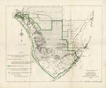
| Proposed final boundary, Everglades National Park, Florida |
|
|
| Proposed final boundary, Everglades National Park, Florida |
|
 |
| Quality of Surface Water in the Vicinity of Oil Exploration Sites, Big Cypress Area, South Florida |
|
|
| Quality of Surface Water in the Vicinity of Oil Exploration Sites, Big Cypress Area, South Florida |
|
|
 |
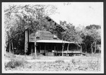
| Royal Palm State Park, 1920-1929 |
|
|
| Royal Palm State Park, 1920-1929 |
|
 |
| Royal Palm State Park towards Tamiami Trail, 1929 |
|
|
| Royal Palm State Park towards Tamiami Trail, 1929 |
|
|
 |
| Seminole Indian patchwork, 1921-1927 |
|
|
| Seminole Indian patchwork, 1921-1927 |
|
 |
| Seminole Indian villages, 1928-1929 |
|
|
| Seminole Indian villages, 1928-1929 |
|
|
 |
| Seminole Indians, 1920-1929 |
|
|
| Seminole Indians, 1920-1929 |
|
 |
| Seminole Indians fishing and preparing food, 1920-1923 |
|
|
| Seminole Indians fishing and preparing food, 1920-1923 |
|
|
 |
| Seminole Indians with dugout canoes, 1920-1928 (bulk 1920) |
|
|
| Seminole Indians with dugout canoes, 1920-1928 (bulk 1920) |
|
 |
| Tamiami Trail and environs west of Forty Mile Bend and east of Monroe Station, 1929 |
|
|
| Tamiami Trail and environs west of Forty Mile Bend and east of Monroe Station, 1929 |
|
|
 |
| Tamiami Trail construction, 1920-1922 |
|
|
| Tamiami Trail construction, 1920-1922 |
|
 |
| Tamiami Trail opening, 1928 |
|
|
| Tamiami Trail opening, 1928 |
|

