| |
|
 |
| Bird's eye drawing of Key West |
|
| Publication Date: | |
1894
|
| Format: | |
Undetermined
|
| Subjects.Display: | |
Maps
Florida--Key West
|
| Source Institution: | |
Florida International University
|
|
| Bird's eye drawing of Key West |
|
 |
| General Topographical Map Sheet XI |
|
| Publication Date: | |
1891/1895
|
| Creator: | |
United States. War Department.
Julius Bien & Co.
|
| Publisher.Display: | |
Washington: G.P.O.
|
| Format: | |
1 map : col. ; 41 x 69 cm.
|
| Subjects.Display: | |
Florida
Florida, U.S.A.
Railroads
Military bases
Swamps
History -- Civil War, 1861-1865
United States -- History -- Civil War, 1861-1865
Maps -- Florida
|
| Source Institution: | |
Florida International University
|
|
| General Topographical Map Sheet XI |
|
|
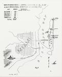 |
| Location map of Pratt General Hospital former Biltmore Hotel. Coral Gables, Florida |
|
| Publication Date: | |
1942
|
| Format: | |
10 X 8 in.
|
| Subjects.Display: | |
Coral Gables (Fla.)--History--Pictorial works
Historic sites--Florida
Hospitals--Florida
Military maps--Florida
|
| Source Institution: | |
Florida International University
|
|
| Location map of Pratt General Hospital former Biltmore Hotel. Coral Gables, Florida |
|
 |
| Map of Boynton Beach drawn by Lyman Boomer, 1910 |
|
| Publication Date: | |
1910
|
| Format: | |
scan only
|
| Subjects.Display: | |
Maps
Map Collection
|
| Source Institution: | |
Boynton Beach City Library Local History Archives
|
|
| Map of Boynton Beach drawn by Lyman Boomer, 1910 |
|
|
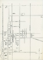 |
| Map of Boynton streets, c. 1945 |
|
| Publication Date: | |
1940/1949
|
| Format: | |
1 black and white document; 8 x 12 inches
|
| Subjects.Display: | |
Maps
Map Collection
|
| Source Institution: | |
Boynton Beach City Library Local History Archives
|
|
| Map of Boynton streets, c. 1945 |
|
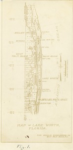 |
| Map of Lake Worth Florida, 1925 |
|
| Publication Date: | |
1925
|
| Creator: | |
Ray B. Dame ( Photographer )
|
| Format: | |
1 black and white print; 4.5 x 9 inches
|
| Subjects.Display: | |
Bridges
Canals
Maps
Boynton Inlet (Boynton Beach, Fla.)
Riddle Engineering Company
Lake Worth (Fla.)--Maps
Riddle Engineering Photoalbum
|
| Source Institution: | |
Boynton Beach City Library Local History Archives
|
| Donor: | |
Gift of Linda Jackson.
|
|
| Map of Lake Worth Florida, 1925 |
|
|
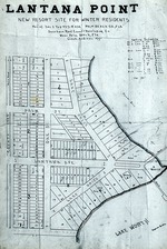 |
| Plat of Lantana Point, 1912 |
|
| Publication Date: | |
1912
|
| Format: | |
1 black and white slide; 1 x .7 inches
|
| Subjects.Display: | |
Maps
Mary Linehan Slide Collection
Plats
|
| Source Institution: | |
Boynton Beach City Library Local History Archives
|
| Donor: | |
Scan gift of Lantana Public Library.
|
|
| Plat of Lantana Point, 1912 |
|
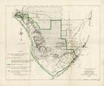 |
| Proposed final boundary, Everglades National Park, Florida |
|
| Publication Date: | |
1957-04
|
| Creator: | |
United States Department of the Interior, National Park Service
|
| Publisher.Display: | |
United States Department of the Interior National Park Service
|
| Format: | |
1 map: 14 x 17 in.
|
| Subjects.Display: | |
Everglades National Park (Fla.)
United States--Florida--Monroe County
United States--Florida--Collier County
United States--Florida--Miami-Dade County
National parks and reserves--Maps--Florida--Everglades National Park
|
| Source Institution: | |
Florida International University
|
|
| Proposed final boundary, Everglades National Park, Florida |
|
|
 |
| Records pertaining to Everglades land in T59S R37E |
|
| Publication Date: | |
1911
|
| Creator: | |
Model Land Company
Reclaiming the Everglades ( Contributor )
Ingraham, James Edmundson, 1850-1924 ( contributor )
Morse, Frederick S., 1859-1920 ( contributor )
|
| Format: | |
33 items (34 p.), 1 map. : ;
|
| Subjects.Display: | |
Maps -- Everglades (Fla.)
Florida Fruit Land Company
Indian reservations -- Maps -- Florida
Seminole Indians -- Reservations
Krome, William J. -- 1876-1939
Holmberg, J. L.,--Dr.
Richardson Kollet Company
|
| Source Institution: | |
Florida International University
|
|
| Records pertaining to Everglades land in T59S R37E |
|
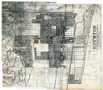 |
| Riddle Engineering map of Boynton, c. 1927 |
|
| Publication Date: | |
1926/1928
|
| Format: | |
1 black and white document; 17 x 20 inches
|
| Subjects.Display: | |
Maps
Map Collection
|
| Source Institution: | |
Boynton Beach City Library Local History Archives
|
|
| Riddle Engineering map of Boynton, c. 1927 |
|
|
 |
| Zoning ordinance of the city of Coral Gables, Florida |
|
| Publication Date: | |
1951
|
| Creator: | |
Coral Gables (Fla.). City Commission
|
| Format: | |
27 p., [2] leaves of plates : col. maps ; 29 cm.
|
| Subjects.Display: | |
Miami-Dade County (Fla.)
Zoning law -- Florida -- Coral Gables ( lcsh )
Zoning -- Florida -- Coral Gables ( lcsh )
Ordinances, Municipal -- Florida -- Coral Gables ( lcsh )
Zoning -- Maps -- Florida -- Coral Gables ( lcsh )
|
| Source Institution: | |
Florida International University
|
|
| Zoning ordinance of the city of Coral Gables, Florida |
|
|

