| |
|
 |
| Mapping the impacts of natural hazards and technological accidents in Europe |
|
| Publication Date: | |
2010-01
|
| Creator: | |
Disaster Risk Reduction Program, Florida International University (DRR/FIU) ( summary contributor )
Wehrli, A. ( editor )
Herkendell, J. ( editor )
Jol, A. ( editor )
|
| Publisher.Display: | |
European Environment Agency (EEA) ( Copenhagen, Denmark )
|
| Subjects.Display: | |
Natural hazards and disasters -- Europe
Accidents -- Technology
|
| Source Institution: | |
Florida International University
|
|
| Mapping the impacts of natural hazards and technological accidents in Europe |
|
 |
| Mapping tree canopy in Broward County, Florida |
|
| Publication Date: | |
2001-07
|
| Creator: | |
Marrow, Victoria
Young, Jill
Roberts, Charles
|
| Format: | |
pdf
|
| Subjects.Display: | |
City planning.
Urban forestry.
City planning -- Florida -- Broward County.
Urban forestry -- Florida -- Broward County.
|
| Source Institution: | |
South Florida Collection, Government Resources and Information Department, Green Library, Florida International University
|
|
| Mapping tree canopy in Broward County, Florida |
|
|
 |
| Mapping vulnerability to climate change |
|
| Publication Date: | |
2011-01
|
| Creator: | |
Disaster Risk Reduction Program, Florida International University (DRR/FIU) ( summary contributor )
World Bank ( contributor )
Heltberg, Rasmus
Bonch-Osmolovskiy, Misha
|
| Publisher.Display: | |
World Bank ( Washington, DC )
|
| Format: | |
eBook : Document : International government publication; 1 online resource (20 p.)
|
| Subjects.Display: | |
Climate change, economies, and society -- Tajikistan
Climate Change Mitigation -- Tajikistan
Population policy -- Tajikistan
Agriculture -- Tajikistan
|
| Source Institution: | |
Florida International University
|
|
| Mapping vulnerability to climate change |
|
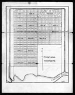 |
| Maps and documents relating to property in the proposed town of Poinciana |
|
| Publication Date: | |
1925/1929
|
| Creator: | |
Reclaiming the Everglades
Smith, Loren E
|
| Format: | |
6 items. : ;
|
| Subjects.Display: | |
Real estate development -- Florida -- Everglades
Maps -- Everglades (Fla.)
Lostman's River (Fla.)
Onion Key (Fla.)
Poinciana (Fla.)
|
| Source Institution: | |
Florida International University
|
|
| Maps and documents relating to property in the proposed town of Poinciana |
|
|
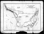 |
| Maps and documents relating to property in the proposed town of Poinciana |
|
| Publication Date: | |
1925/1929
|
| Creator: | |
Reclaiming the Everglades
Smith, Loren E
|
| Format: | |
6 items. : ;
|
| Subjects.Display: | |
Real estate development -- Florida -- Everglades
Maps -- Everglades (Fla.)
Lostman's River (Fla.)
Onion Key (Fla.)
Poinciana (Fla.)
|
| Source Institution: | |
Florida International University
|
|
| Maps and documents relating to property in the proposed town of Poinciana |
|
 |
| Maps and letter relating to Cape Sable and Monroe County, Fla., 1927-1930. |
|
| Creator: | |
Model Land Company.
Bowen, Reeves. ( Contributor )
Hoffman, J. W. ( Contributor )
|
| Format: | |
3 items
|
| Subjects.Display: | |
Sable, Cape (Fla.)
Everglades (Fla.)--Maps.
|
| Source Institution: | |
Florida International University
|
|
| Maps and letter relating to Cape Sable and Monroe County, Fla., 1927-1930. |
|
|
 |
| Maps of Lands Vulnerable to Sea Level Rise |
|
| Publication Date: | |
2000
|
| Creator: | |
James G. Titus
Charlie Richman
|
| Publisher.Display: | |
Inter-Research Science Center
|
| Subjects.Display: | |
Climate change
Global warming
Sea Level rise
Maps
Coastal Erosion
|
| Source Institution: | |
Florida International University
|
|
| Maps of Lands Vulnerable to Sea Level Rise |
|
 |
| Maps of Lands Vulnerable to Sea Level Rise |
|
| Publication Date: | |
2000
|
| Creator: | |
J.G. Titus
C. Richman
|
| Subjects.Display: | |
Climate change
Sea Level rise
Maps
Atlantic Region
|
| Source Institution: | |
Florida International University
|
|
| Maps of Lands Vulnerable to Sea Level Rise |
|
|
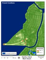 |
| Maps of Sea Level Rise- Nautilus Island,Miami Beach, FL |
|
| Publication Date: | |
2014
|
| Creator: | |
Harlem, P.W.
|
| Subjects.Display: | |
Miami Beach (Fla.)
Climate change
Sea Level rise
Tides
|
| Source Institution: | |
Florida International University
|
|
| Maps of Sea Level Rise- Nautilus Island,Miami Beach, FL |
|
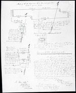 |
| Maps of the Old Magazine lot or Governors Garden |
|
| Creator: | |
Anon.
|
| Format: | |
map
|
| Subjects.Display: | |
Survey
|
| Source Institution: | |
University of Florida
|
|
| Maps of the Old Magazine lot or Governors Garden |
|
|
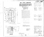 |
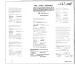
| Mar Street Subdivision (Sheet 1 of 2) |
|
| Publication Date: | |
1982-12-14
|
| Creator: | |
Ten Broeck Associates, Inc.
|
| Format: | |
map
|
| Subjects.Display: | |
Coral Gables (Fla.)
Real property--Maps
Cadastral maps
Plat books
|
| Source Institution: | |
Florida International University
|
|
| Mar Street Subdivision (Sheet 1 of 2) |
|
 |
| Mar Street Subdivision (Sheet 2 of 2) |
|
| Publication Date: | |
1982-12-14
|
| Creator: | |
Ten Broeck Associates, Inc.
|
| Format: | |
signature page
|
| Subjects.Display: | |
Coral Gables (Fla.)
Real property--Maps
Cadastral maps
Plat books
|
| Source Institution: | |
Florida International University
|
|
| Mar Street Subdivision (Sheet 2 of 2) |
|
|
 |
| Mara dryland becomes wetland |
|
| Publication Date: | |
2007-11-26
|
| Creator: | |
Bogers, Ewald
|
| Publisher.Display: | |
University of Amsterdam
|
| Format: | |
Thesis/dissertation
|
| Subjects.Display: | |
Ecology
Tanzania
Sustainable
Livelihood
Wetland
Social
Adaptation
|
| Source Institution: | |
Florida International University
|
|
| Mara dryland becomes wetland |
|
 |
| The Mara River basin expedition for no water no life |
|
| Publication Date: | |
2010-03-01
|
| Creator: | |
Jones, Alison M.
|
| Publisher.Display: | |
No Water No Life
|
| Format: | |
Report
|
| Subjects.Display: | |
Water resources
Limnology
Pastoralist
Land-use
Tourism
|
| Source Institution: | |
Florida International University
|
|
| The Mara River basin expedition for no water no life |
|
|
 |
| Mara River basin monograph |
|
| Publication Date: | |
2008-12
|
| Creator: | |
WREM International Inc.
|
| Publisher.Display: | |
WREM International Inc.
|
| Format: | |
Report
|
| Subjects.Display: | |
Environment
Ecology
Natural resources
Water resources
Water management
Land-use
Transboundary
|
| Source Institution: | |
Florida International University
|
|
| Mara River basin monograph |
|
 |
| Marabella Avenue, Coral Gables, Florida |
|
| Publication Date: | |
1949
|
| Creator: | |
Kerdyk Realty ( Contributor )
|
| Format: | |
4 x 6 in
|
| Subjects.Display: | |
Coral Gables (Fla.)--History--Pictorial works
Dwellings--Florida--Coral Gables
Architecture, Domestic--Florida--Coral Gables
|
| Source Institution: | |
Florida International University
|
|
| Marabella Avenue, Coral Gables, Florida |
|
|
 |
| Maracas |
|
| Creator: | |
Lecuona, Ernesto ( composer )
Ruby, Harry ( composer )
Jose Curbelo and his orchestra ( Performer )
|
| Publisher.Display: | |
Victor
|
| Format: | |
1 sound disc : 78 rpm ; 10 in.
|
| Source Institution: | |
Florida International University
|
| Donor: | |
Cristobal Diaz Ayala
|
|
| Maracas |
|
 |
| Marc Bazin |
|
| Publication Date: | |
1986-10-20
|
| Format: | |
Cassette, Soyn HF60
|
| Subjects.Display: | |
Bazin, Marc, 1932-2010
|
| Source Institution: | |
Florida International University
|
| Donor: | |
Diederich, Bernard
|
|
| Marc Bazin |
|
|
 |
| Marc Bazin |
|
| Publication Date: | |
1987-10-07
|
| Format: | |
Cassette, Sony HF60
|
| Source Institution: | |
Florida International University
|
| Donor: | |
Diederich, Bernard
|
|
| Marc Bazin |
|
 |
| Marcada |
|
| Creator: | |
Gil ( composer )
Navarro ( composer )
Rodriguez ( composer )
|
| Publisher.Display: | |
Columbia
|
| Format: | |
1 sound disc : 78 rpm ; 10 in.
|
| Source Institution: | |
Florida International University
|
| Donor: | |
Jaime Canaves
|
|
| Marcada |
|

